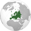
文件:Europe (orthographic projection).svg

原始文件 (SVG文件,尺寸为541 × 541像素,文件大小:239 KB)
本文件来自维基共享资源并可能被其他项目使用。 其文件描述页上的描述显示在下面。
Saegmangj
| 描述Europe (orthographic projection).svg |
العربية: الخريطة الهجائية لأوروبا English: Europe
Français : Europe ქართული: ევროპა |
||||
| 日期 | |||||
| 来源 |
自己的作品
|
||||
| 作者 | Ssolbergj | ||||
| 其他版本 |
Derivative works of this file: Europe orthographic Caucasus Urals boundary.svg العربية: الرجاء، قراءة الميثاق.
বাংলা: দয়া করে, রীতিনীতিটি পড়ুন।
Deutsch: Bitte lies die Konventionen.
English: Please, read the conventions.
Español: Por favor, lea las convenciones.
Filipino: Paki-basa ang mga kumbensyon.
Français : S'il vous plaît, lisez les conventions.
हिन्दी: कृपया सभागमों को पढ़ लें.
Bahasa Indonesia: Silakan, baca konvensi.
Italiano: Si prega di leggere le convenzioni.
日本語: 規約をご確認ください。
ქართული: გთხოვთ, გაეცნოთ კონვენციებს.
Македонски: Ве молиме, прочитајте ги општоприфатените правила.
Português: Por favor, leia as convenções.
Русский: Пожалуйста, прочитайте соглашения.
Tagalog: Paki-basa ang mga kumbensyon.
Українська: Будь ласка, прочитайте конвенції.
Tiếng Việt: Hãy đọc công văn trước khi đăng.
中文(繁體):請檢視常規
中文(简体):请查看常规
|
||||
| SVG开发 InfoField |
许可协议
| Public domainPublic domainfalsefalse |
| 此地图不符合版权的资格,因此属于公有领域,因为其完全包含公共财产信息,不包含原作者身份。详情参见Commons:Threshold of originality § Maps。
English | Español | Galego | Română | slovenščina | العربية | 简体中文 | 繁體中文 | +/− |
| Annotations InfoField | This image is annotated: View the annotations at Commons |
Poland
Spain
Portugal
Africa
Asia
Norway
France
Italy
America
Moldova
United Kingdom
Russia
Ireland
Greece
Finland
Germany
Denmark
Corsica
Switzerland
Bulgaria
Iceland
Sicilia
Cyprus
Malta
Estonia
Svalbard
Greenland
Sardinia
Albania
Austria
Balearic Islands
Crete
说明
此文件中描述的项目
描绘内容 简体中文
许可协议 简体中文
GNU自由文档许可证1.2或更高版本 简体中文
成立或创建时间 简体中文
7 1 2009
媒体类型 简体中文
image/svg+xml
文件历史
点击某个日期/时间查看对应时刻的文件。
| Ngoenz/Seizgan | 缩略图 | 大小 | Bouxsawjyungh | Gejgangj | |
|---|---|---|---|---|---|
| seizneix | 2024年11月10日 (Ngoenz) 16:12 |  | 541 × 541(239 KB) | ReneeWrites | Reverted to version as of 09:46, 31 January 2016 (UTC) - Vandalism |
| 2016年1月31日 (Ngoenz) 09:46 |  | 541 × 541(239 KB) | Christina1969 | Reverted to version as of 19:08, 20 June 2009 (UTC) | |
| 2013年9月8日 (Ngoenz) 20:21 |  | 541 × 541(235 KB) | Chipmunkdavis | Reverted to version as of 22:37, 8 July 2009 Restore to version which notes source | |
| 2012年9月12日 (Sam) 20:11 |  | 541 × 541(82 KB) | Palosirkka | Scrubbed with http://codedread.com/scour/ | |
| 2011年4月4日 (It) 18:44 |  | 541 × 541(235 KB) | Green, White and Gold | Reverted to version as of 22:37, 8 July 2009 | |
| 2011年4月3日 (Ngoenz) 04:49 |  | 541 × 541(239 KB) | ComtesseDeMingrelie | correcting Phasis riverbank | |
| 2011年4月3日 (Ngoenz) 04:49 |  | 541 × 541(235 KB) | ComtesseDeMingrelie | more common | |
| 2011年4月3日 (Ngoenz) 04:44 |  | 541 × 541(235 KB) | ComtesseDeMingrelie | most common definition | |
| 2009年7月8日 (Sam) 22:37 |  | 541 × 541(235 KB) | Bosonic dressing | rv: yes - per Natl Geographic Atlas of the World, which trumps what might be an original concoction | |
| 2009年7月5日 (Ngoenz) 13:50 |  | 541 × 541(235 KB) | Ssolbergj | I based the border on http://en.wikipedia.org/wiki/File:Map_of_Europe_(political).png. Do you have a more reliable source? |
文件用途
没有页面使用本文件。
全域文件用途
以下其他wiki使用此文件:
- ace.wikipedia.org上的用途
- Itali
- Peurancih
- Siprus
- Turuki
- Vatikan
- Iërupa
- Jeureuman
- Rumania
- Hongaria
- Polandia
- Moldova
- Austria
- Bèlgia
- Liechtenstein
- Luksèmburg
- Monakô
- Blanda
- Swiss
- Bèlarusia
- Bulgaria
- Ukraina
- Slowakia
- Rusia
- Denmark
- Swèdia
- Irlandia
- Islandia
- Latvia
- Lithuania
- Finlandia
- Èstonia
- Albania
- Andorra
- Bosnia Hèrzègovina
- Kroasia
- Malta
- Yunani
- Seupanyo
- Sèrbia
- San Marino
- Portugéh
- Monténègrô
- Slovenia
- Norwègia
- Cèkia
- Pola:Iërupa
- Kosovô
- af.wikipedia.org上的用途
查看此文件的更多全域用途。
元数据
此文件含有额外信息,这些信息可能是创建或数字化该文件时使用的数码相机或扫描仪所添加的。如果文件已从其原始状态修改,某些详细信息可能无法完全反映修改后的文件。
| 宽度 | 541.47876 |
|---|---|
| 高度 | 541.47876 |


