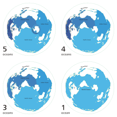
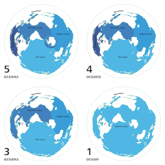
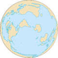
文件:World ocean map.gif
外观
World_ocean_map.gif (500 × 500像素,文件大小:68 KB,MIME类型:image/gif、循环、4帧、10秒)
文件历史
点击某个日期/时间查看对应时刻的文件。
| Ngoenz/Seizgan | 缩略图 | 大小 | Bouxsawjyungh | Gejgangj | |
|---|---|---|---|---|---|
| seizneix | 2007年4月8日 (Ngoenz) 04:12 |  | 500 × 500(68 KB) | Quizatz Haderach | Animated world ocean map! |
文件用途
以下页面使用本文件:
全域文件用途
以下其他wiki使用此文件:
- ab.wikipedia.org上的用途
- am.wikipedia.org上的用途
- ang.wikipedia.org上的用途
- arc.wikipedia.org上的用途
- ar.wikipedia.org上的用途
- as.wikipedia.org上的用途
- ban.wikipedia.org上的用途
- ba.wikipedia.org上的用途
- bcl.wikipedia.org上的用途
- be-tarask.wikipedia.org上的用途
- bew.wikipedia.org上的用途
- bg.wikipedia.org上的用途
- bi.wikipedia.org上的用途
- bjn.wikipedia.org上的用途
- blk.wikipedia.org上的用途
- bn.wikipedia.org上的用途
- br.wikipedia.org上的用途
- bs.wikipedia.org上的用途
- bxr.wikipedia.org上的用途
- ca.wikipedia.org上的用途
- ce.wikipedia.org上的用途
- ch.wikipedia.org上的用途
- crh.wikipedia.org上的用途
- da.wikipedia.org上的用途
- de.wiktionary.org上的用途
- diq.wikipedia.org上的用途
- dtp.wikipedia.org上的用途
- el.wikipedia.org上的用途
- en.wikipedia.org上的用途
查看此文件的更多全域用途。


